Blog 5: Namibia and hydro political conflict over the Orange-Senqu River
The Orange Senqu River is located in southern Africa and is shared by three countries; Lesotho, South Africa and Namibia, with Botswana being a riparian state (Sebastian, 2008). The river originates in the Lesotho Highlands where it is known as the Senqu River, and travels through to South Africa, Namibia and Botswana in the north. The river stretches for 2300km from its source to the Atlantic Ocean and is one of the largest and longest rivers in all of Southern Africa, covering an area of approximately 964, 000km2 (Conley and van Niekerk, 1998).
| Map showing the location and journey of the Orange-Senqu River |
Namibia is an extremely arid country with great scarcities of water in most areas, access to water is its single, dominant, limiting factor. The Lower Orange River, the area where South Africa and Namibia share the border, is controlled by South Africa and it is South Africa that controls the mineral resources on the land that depends upon the water. Access to the basin would mean that Namibia would have access to one of the biggest diamond mines in Southern Africa, 'rich, alluvial diamond beds' that would be a huge source of income for the country that could be used as a multiplying factor for further development in other areas (Sebastian, 2008). As there are no dams on the common lower Orange River border running between Namibia and South Africa to the Atlantic Ocean, Namibia is dependent upon South Africa for river regulation and the release of water from upstream dams. This also means that it has to depend on South Africa as its main source of electrical power, a hydro-power dependency that the government would like to reduce (Heyns et al, 2008). Access to the basin would also mean that the country would have access to one of the biggest diamond mines in Southern Africa, 'rich, alluvial diamond beds' that would be a huge source of income for the country that could be used as a multiplying factor for further development in other areas (Sebastian, 2008).
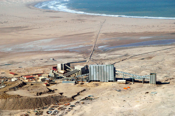 |
| Image showing a diamond mine in Sperrgebiet, Namibia |
The conflict between Namibia and South Africa over the Orange-Senqu river border is multifaceted, encompassing historical and colonial legacies, a number of agreements and false promises, and all the potential assets that one country could gain, which have been mentioned above. Originally, the conflict originated in 1899 when the fixing of the boundary as either the middle of the river (what Namibia believes is just) or on its northern bank (what South Africa wants), is believed to have been a 'protracted dispute between Great Britain and Germany, centred firstly on the question of access to water for German subjects in Namaland', it ended with the request that the middle of the river, be adopted as the international boundary on the Orange-Senqu River (Sebastian, 2008). Since then, the border and therefore the ownership of the body of water and its assets, has been a point of hot contention between Namibia and South Africa.
in 1994, SA President Nelson Mandela and his cabinet decided to move the border to the middle of the river, this has since been definitively denied by the rest and incumbent governments, describing the sudden change on South Africa's position as a 'memory lapse' (Maletsky, 2000). In response, South Africa continues to adhere to the colonial July 1980 Berlin Agreement between Great Britain and Germany, which establishes the border on the northern side of the bank (Sebastian, 2008). - During the boundary dispute between Namibia and South Africa, the ‘shadows of the past’, along with Namibia’s continuous efforts to demonstrate its sovereign independence in the presence of South Africa’s regional and riparian hegemony.
Overall, the conflict over the Orange-Senqu is a matter of colonial legacy, whereby conflict has arisen over the resource, both due to its potential assets and due to its geographical location. Both factors have become inextricably linked, due to the history of conflict in the area, that has enabled South Africa to continue to have the upper hand in the matter, reminiscent of its colonial power over Namibia and its dependency on its former governor. The situation has left Namibia in a state of dependency, both in terms of the resources that South Africa allows it and the loss of the resources it could gain and use to further its own development.

Interesting topic! I wanted to ask you about what you might believe are the potential solutions for Namibia's water dependency? Could Namibian communities obtain water from an alternative source or will the hydro political conflict with South Africa remain? I am excited to hear what you think!
ReplyDelete